How to interpret MSL lines on a chart
Moderators: Redneck_Randy, badmoonrising, lakerunner
How to interpret MSL lines on a chart
I have a Kingfisher map of Lake Murray, SC. Depths are indicated by color and contour lines. I understand, in a generic sense, that the contour lines show Feet Above Mean Sea Level. I don't understand how to interpret that in a useful way. Lake Murray was created by flooding a hilly landscape. You can go from deep to shallow very quickly. I just want to avoid messing up my prop. The legend indicates three categories: (1) Darker shaded areas, 360' MSL (0-20'); (2) Middle shaded areas, 340' MSL (20-40'); (3) Light shaded areas, 320' MSL (40' to max depth). Those categories are too broad to be useful. The chart is peppered with numbers that seem to range from around 2 to 285, but they are not referenced in the legend and they do not seem to be depth indicators. If there is a quick explanation of how to interpret depth on this chart in reasonably fine increments, can you share that information?
Re: How to interpret MSL lines on a chart
All I can add is you are wanting 3 ft below to be comfortable, our lakes have bouys to mark low areas, we are a TVA system lake and can go from 0' to 280' quickly, p hope that helps 
Check out "Dudes" site www.whereisdude.com
Re: How to interpret MSL lines on a chart
I am by far an expert here but I believe MSL relates to tidal waters. As far as lake charts go, most are above sea level so I would not think MSL applies.
If you are on one of those lakes that dam/water level management can change water depths dramatically I think you just error on the side of caution. Now if you arrive at a lake and the water level is obviously way down as evidenced by the shoreline you need to be extra careful.
If you are on one of those lakes that dam/water level management can change water depths dramatically I think you just error on the side of caution. Now if you arrive at a lake and the water level is obviously way down as evidenced by the shoreline you need to be extra careful.
I am the guy at the boat ramp that gives you dirty looks when you are a complete idiot and too stupid to know it.
Re: How to interpret MSL lines on a chart
A decent gps fish finder will help you on lake Murray. lake Murray is not a hard lake to navigate and is well marked usually and has good depth. Though occasionally the markers get damaged and it can take a little while for them to be replaced. I have a Humminbird Helix 5 on my pontoon that came with a decent built in chart showing the contours of the lake bottom for Lake Murray. It even shows the docks on the shoreline. On my runabout boat I have a garmin that does pretty well. One thing to keep in mind with the charts is the lake level. We are at 357.67 right now. 360 is full stage but the most they normally let it get to is 358.2 or so. That is pretty full so navigating is easier. Earlier this year they lowered it to 354 for the winter drawdown making it a little more hazardous. https://waterdata.usgs.gov/sc/nwis/uv/?site_no=02168500 Pay attention to the water level and have a decent gps fishfinder would be my advice. https://www.amazon.com/Humminbird-41021 ... 404&sr=8-3 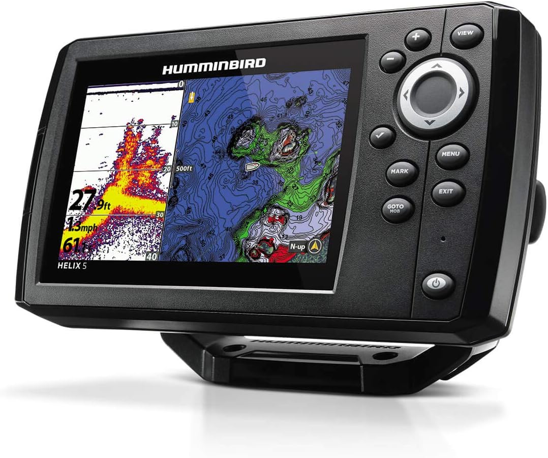
Re: How to interpret MSL lines on a chart
Pretty sure these are actual depths (not related to MSL) on this map at normal pool.
https://usa.fishermap.org/depth-map/mur ... #add_block
https://usa.fishermap.org/depth-map/mur ... #add_block
SOLD - 2009 20' Bentley w/4 Stroke 90hp Mercury
SOLD - 2011 SouthBay 522CR w/115 4 Stroke Mercury
2014 Xcursion 23RF XS package w/150 4 Stroke Mercury
SOLD - 2011 SouthBay 522CR w/115 4 Stroke Mercury
2014 Xcursion 23RF XS package w/150 4 Stroke Mercury
Re: How to interpret MSL lines on a chart
I can confirm what Bobi said. I live on Lake Murray and those are actual depths below full pool (360 ft). The lake rarely gets above 358 unless we have pretty heavy rains (re. 2015 flood it hit 359.9 and 360 within 3 months of each other). As long as you watch for shoal markers and have a decent depth finder you can go just about anywhere.
Maybe we will see you out and about this spring/summer!
Maybe we will see you out and about this spring/summer!
---------------------------
Steve
2006 Fisher 221 DLX 3.0L MerCruiser I/O
Lake Murray
Prosperity, SC
Steve
2006 Fisher 221 DLX 3.0L MerCruiser I/O
Lake Murray
Prosperity, SC