
Considering putting a trip together, sometime in June...
We live in central GA, and don't want to fool with the restrictive lock timing....
We are thinking about putting in, just below Seminole Lake. There's a campground with boat ramp onto the Apalachicola River...
Take the river to Apalachicola, spend the night, then take the intercostal waterway to Panama City Beach.... Spend a few days there, then reverse the process...
I can find tons of info on the river portion, but what I'm having trouble finding, is the 'particulars' about the ICW portion...
Anyone here took this route? I'm betting there is, since there's so many boats down there...
Anyway.... I need to know the approximate travel time/distance from Apalachicola to Panama City Beach... I plan on cruising about 15mph, which to me, is fast enough to put some distance in, but slow enough to take in scenery, save fuel, and hold a conversation on the pontoon....
Are there boating speed limits - other than bridges, etc, that will hinder my speed? I've heard that more and more communities are trying to save the manatee by slowing down boaters.. I even heard of one town, that one of the commissioner's wife doesn't like rolling waves when she rents a boat, so they made speed limits on their waterways.....
Lake Seminole, to Apalachicola, to Panama City Beach...
Moderators: Redneck_Randy, badmoonrising, lakerunner
Lake Seminole, to Apalachicola, to Panama City Beach...
2011 SunChaser DS22
Mercury 115 EFI
13.75 x 15p
Mercury 115 EFI
13.75 x 15p

Re: Lake Seminole, to Apalachicola, to Panama City Beach...
I was trying to search for a quick map, but conditions permitting, and I mean when the Gulf lays down like a crystal blue swimming pool, I think you can exit the IC at Port St. Joe and head west along the coast. Experience Crooked Island, just offshore of Tyndall AFB. Go in behind the island and its like being in the Bahamas. Next Island west is Shell Island at the Panama City Pass into St. Andrews Bay. Tons of dolphins around Shell Island too.
Be glad to help you with any questions about boating St. Andrews Bay.
I never explored the IC much past East St. Adrews Bay. I remember it was feeling pretty tight back there so we turned around. I have run it from PCB to Destin and back.
Be glad to help you with any questions about boating St. Andrews Bay.
I never explored the IC much past East St. Adrews Bay. I remember it was feeling pretty tight back there so we turned around. I have run it from PCB to Destin and back.
Michael and Laura
'12 Ford F150 Lariat SuperCrew Ecoboost
'14 Harris Solstice 220, P3 tritoon, Mercury Verado 150, Enertia 14p.
prior boat: '02 Century 2600CC, twin Yamaha EFI 200's, full instruments.
'12 Ford F150 Lariat SuperCrew Ecoboost
'14 Harris Solstice 220, P3 tritoon, Mercury Verado 150, Enertia 14p.
prior boat: '02 Century 2600CC, twin Yamaha EFI 200's, full instruments.
Re: Lake Seminole, to Apalachicola, to Panama City Beach...
ah, i stumbled across this....
http://www.charts.noaa.gov/InteractiveC ... ?rnc=11401
now... gotta put more information with map.....
http://www.charts.noaa.gov/InteractiveC ... ?rnc=11401
now... gotta put more information with map.....
2011 SunChaser DS22
Mercury 115 EFI
13.75 x 15p
Mercury 115 EFI
13.75 x 15p
Re: Lake Seminole, to Apalachicola, to Panama City Beach...
Respect Our Recreational Resources
Leaving Only "The Footprints of Your Passing"
Boating the Muskingum River
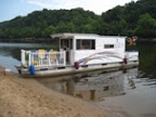
1972 35' Crest Pontoon Houseboat
2007 90 hp. Yamaha
Leaving Only "The Footprints of Your Passing"
Boating the Muskingum River
1972 35' Crest Pontoon Houseboat
2007 90 hp. Yamaha
Re: Lake Seminole, to Apalachicola, to Panama City Beach...
Thanks... i'll check that out
2011 SunChaser DS22
Mercury 115 EFI
13.75 x 15p
Mercury 115 EFI
13.75 x 15p
Re: Lake Seminole, to Apalachicola, to Panama City Beach...
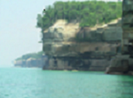
Get a camera and log book if you will for this. Finding information on trip destinations and actual accounts are few and far between. The Wife and I have run the southern shore of Superior, around Pictured Rocks, now 4 times but never had a cam setup like you can get with a GoPro. Got the log book but solid film of the area is valuable.
Case in point was describing the pine poles that you find in the water on Superior. You can put it in words but when you see that much tree bobbing just above water line, ya just get your head on a swivel. Video gets the reality across to the uninitiated.
Case in point was describing the pine poles that you find in the water on Superior. You can put it in words but when you see that much tree bobbing just above water line, ya just get your head on a swivel. Video gets the reality across to the uninitiated.